[A big fat thanks goes to Anna Palmann for editing the post]
So I recently received feedback from a friend about the blog, which I think is worth quoting in full-
"Maybe write a little more about what's going on with you personally? Difficulties, experiences, meetings with people and such? And photos! Of you! And of those you meet. Because with all due respect, i honestly don't give a rat's ass about the housing market in Singapore and the ethnic identity of the Abkhazians in Turkmenistan."
And I said to myself, well, true dat. lately the blog has tended to focus too much on history and identities, etc., or rather, interesting things I've learned about the places I've been to, and less in the perspective of "I'm riding around the world by bike, and here's what happened to me" (although I think the story about the bag From the previous post was excellent, for those who had time to listen to it). So I really intended for this post to be more about my adventure in the Pamir Mountains, and what it was like to ride a bike on one of the highest mountain ranges in the world. But of course, as usual, history and politics and identities did find their way into the story of the Pamirs, because, for example, one cannot not wonder why you need to present your special permit to be in the GBAO at every checkpoint throughout the province. I will try to balance things a bit, and one of the consequences is that there will be a lot of foreshadowing during the post, when I mention something that I will write more about later in the post, so as not to get in too deep in one place. I do want to leave more room for stories from the road, because all in all, the month or so I spent riding across the Pamirs in Tajikistan was probably my biggest travel adventure to date. the post respectively also grew naturally into a rather long one, so it will be divided into two posts. so lets start?
Introduction – where the hell are the Pamir mountains actually?
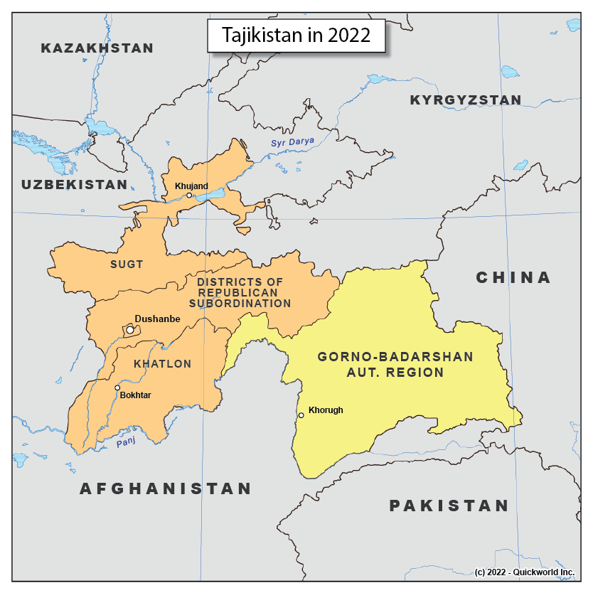
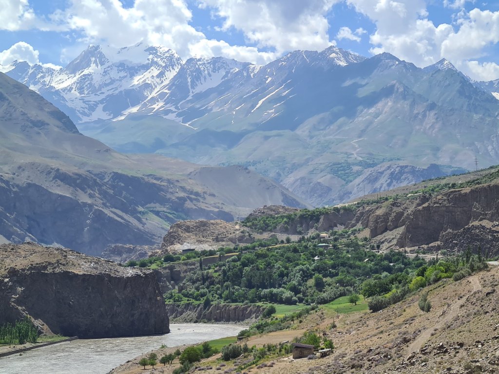
The Pamir Mountains are in the general area of this huge bend in the earth's crust that India's collision with Asia created at that time (the Himalayas are not very far to the south). They themselves are among the highest mountain ranges on the planet (3 peaks over 7000!) and have been nicknamed "the roof of the world". I guess it's because they contain, beyond the ranges themselves, also some very high plateaus (pedaling on an endless plain at 4000 meters above sea level is quite a thing) . They are also considered the holy grail for bicycle travelers who cross Asia, and specifically the dream of many is to ride the M41, known as the Pamir highway, which was gradually built by the Russian Empire and the Soviets after them to strengthen their control of this border area with the British (even if the narrative of The Great Game is exaggerated, and the Russians never really planned to invade India, they were still very suspicious of the British who were sitting across the border, so things were tense). Specifically it was an important connection between Osh, a city in southern Kyrgyzstan and Dushanbe, the capital of Tajikistan today (and onwards to Afghanistan). According to at least one source, The Russians generally invested in the development of the area, to create loyalty of the local population in the border area. Today, on the other hand, it is the most remote area with the worst infrastructure in Tajikistan, at least in terms of roads. Later we will talk about how the area got from a state where it is the most developed in the area to its state today and how it might partially change in the coming years (see? foreshadowing!). Today the Pamirs are in the Gorno Badakshan district in Tajikistan, AKA the GBAO – gorno badakshan autonomous oblast (oblast is a district in Russian), which occupies about 43% of the area of modern Tajikistan, but contains only about 3% of the population. Badakhshan, historically, was a very separate area/political entity from the rest of Tajikistan, and changed hands between Afghanistan, Bukhara, and several small local kingdoms, and finally of course fell into the hands of the Russian Empire. In fact its unification into what became modern Tajikistan only happened in 1929, When the Soviets decided to include it in the Tajik Soviet Socialist Republic (which they actually just separated from Uzbekistan a little before). You could see this as an example of the "stalin giant pencil " I talked about in the previous post, but honestly, hundred thousand or so people in the mountains is not something you can make an independent republic out of (unless you're Lichtenstein), so i think it did made sense to annex it to Tajikistan.
Its inhabitants, the Pamiri people, are also ethnically very diferent from the rest of Tajikistan (and also in some other respects i'll discuss later). They speak the Pamiri language, and to be precise, the Pamiri *languages* – throughout the Pamir there are an incredibly large number of local languages, some of which are spoken by only a few thousand to tens of thousands, such as Wakanite or Ishkosimian, which have probably been preserved thanks to the remoteness and topography. In general, the Pamir languages are Iranian languages like Tajik, but Pamir is a West Iranian language, and Tajik is an East Iranian language, and if that seems like a negligible difference to you, well try having a conversation in Berlin while speaking Dutch. And as I said, this is not the only difference between them and rest of the Tajikistani people, but we will get to that as well.
In any case, all these factors – the topography, the distance, and the poor infrastructure – make the Pamirs one of the most remote and spectacular areas in Central Asia, and therefore crossing the Pamir highway from Dushanbe to Osh is considered the highlight of any bicycle trip in Asia.
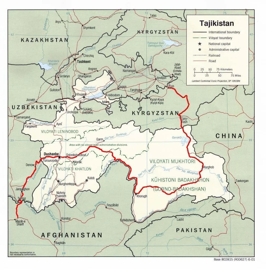
I mean, that was the plan of every cyclist in the area until at least 2021, when Tajikistan and Kyrgyzstan started an ongoing border dispute (water issues, as far as I understand) that closed that border. Which left the cyclists to make a loop through the Bartang Valley, a valley that descends from Lake Karakol, close to the Kyrgyz border, back to the main road to Dushanbe. But even with the closed border, the Pamir is a magnet for cyclists from around the world. And they all all arrive at the Greenhouse Hostel.
Before leaving – the greenhouse
I arrived in Dushanbe after a short and beautiful trek in the Fann Mountains, a small but stunning mountain range in the northwest of the country (yes, Fann, I know, I've already made all the possible jokes). To get to Dushanbe I had to cross the infamous "Tunnel of Death". When I say cross, I mean I climbed up to the tunnel (in a rather breathtaking ride, also because it was beautiful, but mainly because it was steeepppp), then policemen at the entrance stopped me and told me that I can't enter with the bike, because I will suffocate or get run over. Given the fact that it is 5 km of a tunnel without lighting or ventilation, I didn't argue, and I waited patiently until they hitched a ride with some van that hopped me over to the other side, which was even more majestic. The only thing that was a bit of a shame was that the van seemed to have transported some animal or another before, and my bags got a little dirty with… something.
From there I rode the long descent (the pleasure of which was robbed from me by a wicked headwind) to Dushanbe. In Dushanbe I stayed, in the aggregate of three visits, something like 10 days, which is probably the longest I stayed in one place on the trip (if you don't count Cambridge), with Christchurch running a close second place. And all these days I stayed at the Greenhouse Hostel, a place that was the closest to feeling like home in this part of the trip.
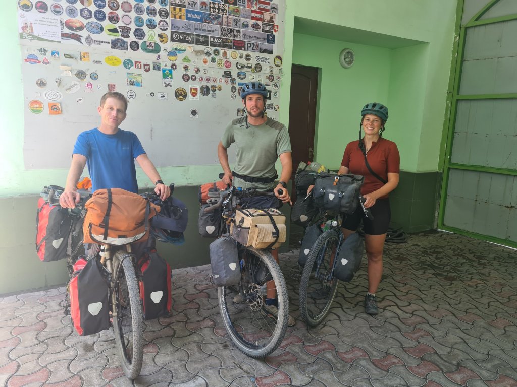
Since Israel is a small and dense country that has no land connection anywhere, bicycle touring, i.e. riding long distances with bags and all that, is not a very popular hobby here (unlike bikepacking, by the way). It's likely that for most of you Israeli readers, I'm the only Israeli you know who has ridden in Central Asia by bike, and it may seem very adventurous/extreme/weird, and sometimes I even buy into my own hype. But I can say that after one day at the Greenhouse Hostel, you feel like the most average and unremarkable person there is, because you are simply surrounded by people who, yes, just arrived here by bike from Europe in three months. On a good day I counted about 15 pairs of bicycles there in the square. Of course, there are also those who fly specifically to Dushanbe to do a tour of the Pamirs and return home, but the majority are travelers like me. By the way, you meet riders from all over the world there (it was especially interesting to meet some older Koreans and Japanese), but the largest demographic group is of course Germans. Germans like to travel and like to ride bikes just as much, it turns out (also the Dutch, but there are fewer of them).
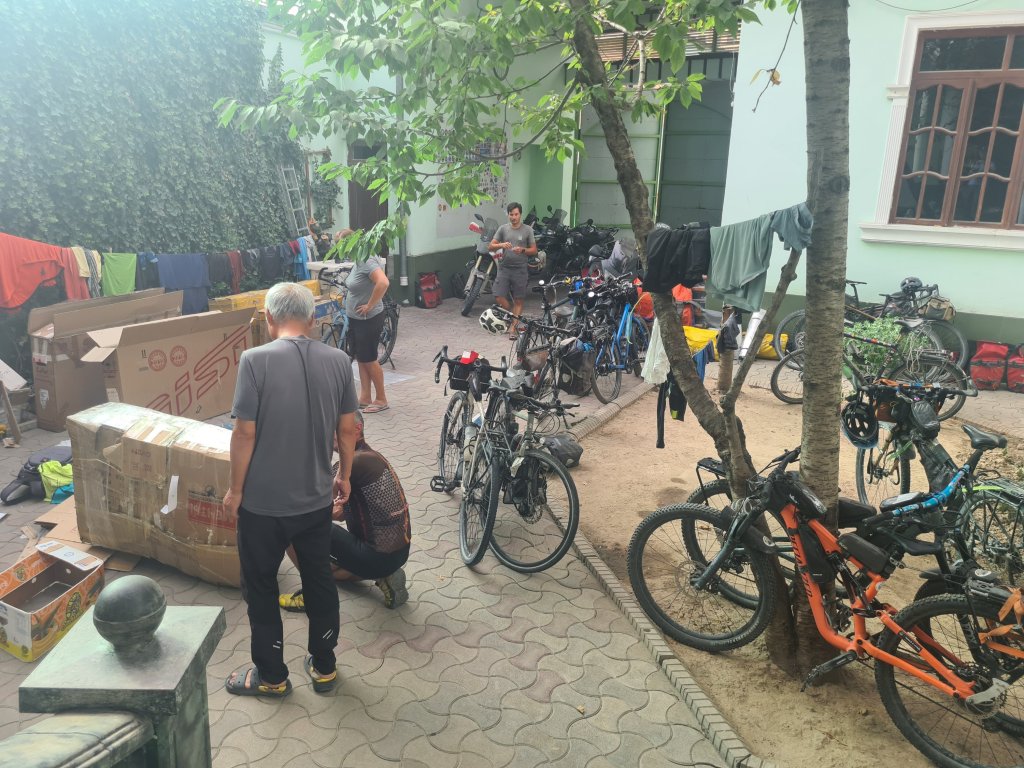
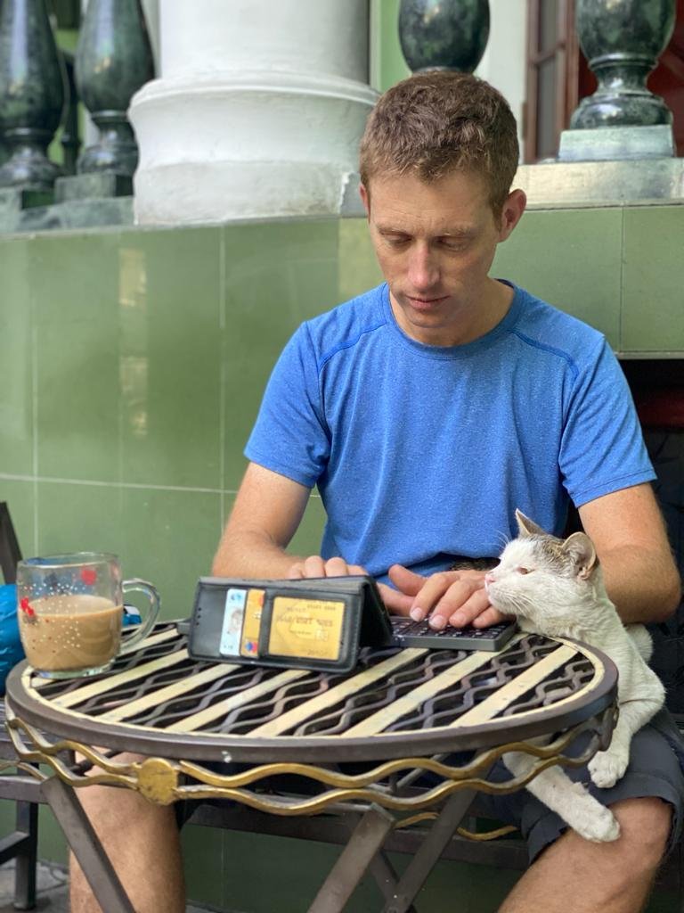
Naturally, cyclists are (mostly) a type of people that I like and feel comfortable with, and there is always something to talk about. I also should note the permanent residents of the greenhouse, meaning the cats and especially the kittens, who were always there, and a significant part of my time there was spent sitting and reading/writing with some kitten milling about me. Between the riders and the cats, it was very nice for me to just stay there for a few days before leaving for the Pamirs.
I personally wasn't at all sure that I wanted to go to the Pamirs when I arrived in Central Asia. First of all, as mentioned, the classic route, from Dushanbe to Osh, was closed due to border disputes between Tajikistan and Kyrgyzstan, and making a loop back through the Bartang Valley sounded less tempting to me at the time – the whole idea of a bicycle trip is that you get from point A to point B with a bicycle , going back and forth feels silly. In addition, when I was in New Zealand I rode with a German guy who rode the loop in the Pamir with a friend and without equipment (accompanied by a jeep), and he told me that it seemed crazy to him to do the Pamir, and especially the Bartang, with full equipment, and he didn't seem to be made of sugar himself . But when I started riding in Uzbekistan, I started meeting more and more riders who seemed perfectly reasonable people and planned to ride the Pamir Hwy, and I started to reconsider that position. However, it was clear to me that I would definitely want to go out there with someone else, because I was a bit hesitant to go out into this particular unknown alone. So I joined Pia and Baldur.
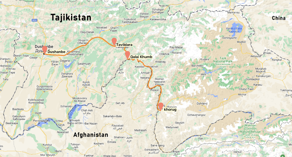
Part I – Dushanbe to Kalai Halomb – riding with Germans and hanging out in the mountains
At one point my sister asked me if "I'm still riding with the elf and the sorcerer", which makes sense, since Pia really looks a bit elfish (and the name there is written in Hebrew like the word "ferry"), and Baldur is unequivocally a name of a powerful sorcerer.
Pia and Baldur are a cycling couple from Germany (of course), both climate scientists who quit their jobs and set off from Germany towards the East and beyond. Since they also encountered the problem of closed borders in Azerbaijan, they spent the winter riding in Africa, then flew back to Central Asia in the spring. I met them even earlier, in Panjakint, and I immediately liked them. I definitely recommended to see their Instagram channel, it's really high quality travel content. Seriously, it makes me feel FOMO over places I have actually been to.
In any case, we set off from Dushanbe to the east. I can't say much about the scenery in the first three days, as a terrible dust storm kicked up over Tajikistan and covered it all in fine haze. On the second day, my cell phone fell off the bike, and in the few minutes it took me to notice it, a kind taxi driver picked it up and drove with it *back to Dushanbe*, so I had to wait in some remote village for half a (rather frustrating) day until the phone came back to me (on the other hand, well, it's better then the alternative. Did I mention that my two credit cards were also on the phone?)
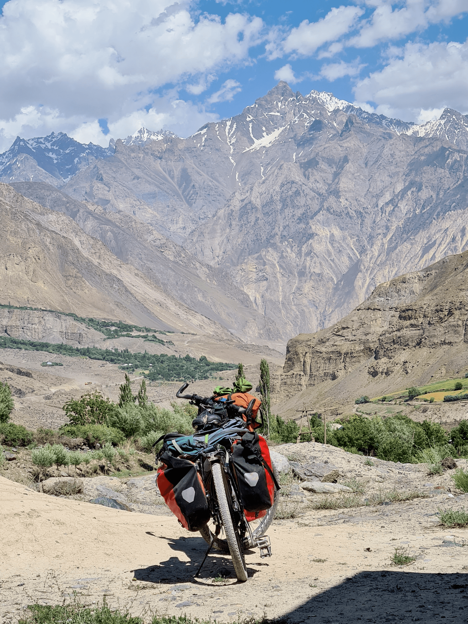
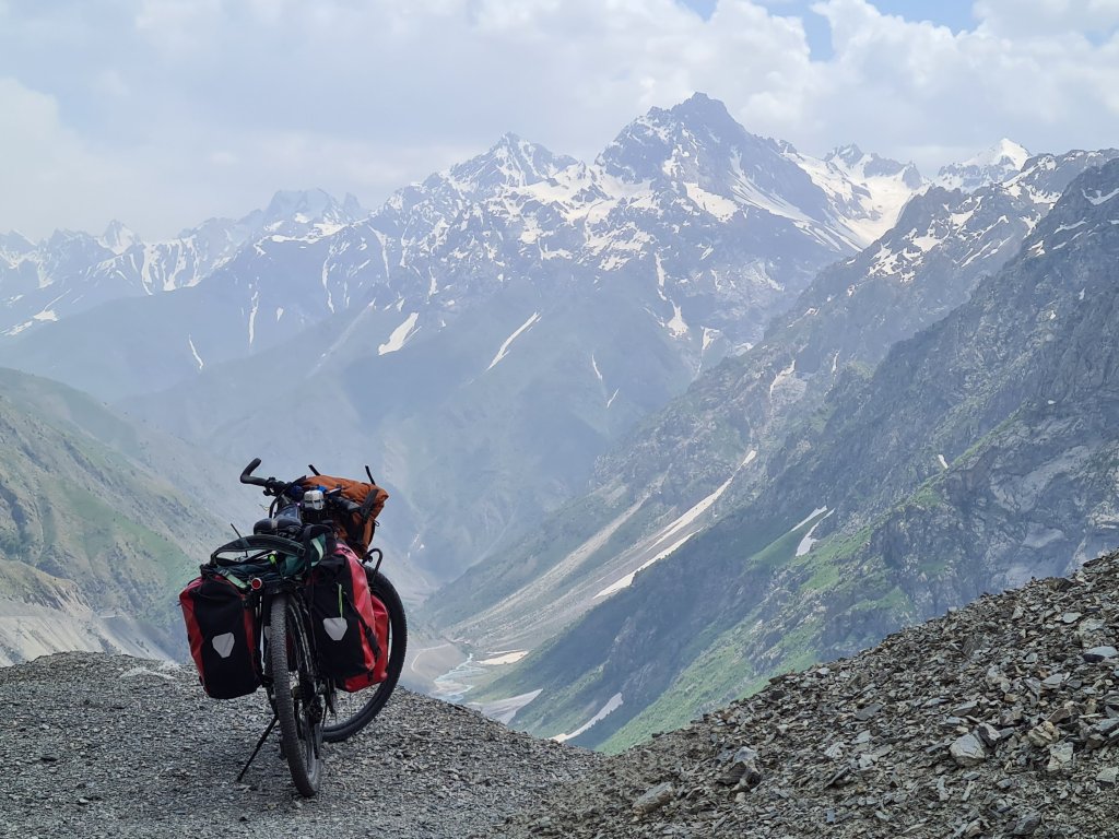
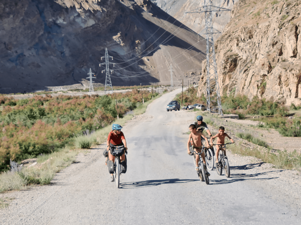
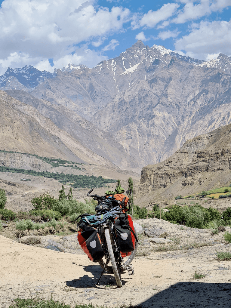
On the third day I did my best to catch up with P&B. After I officially entered GBAO, and went through the first check point where I had to show my permit to enter the province, I started riding through the canyon which was challenging but quite beautiful even when covered in dust, and I ended up finding them drinking coffee on the side of the road. The days with Pia and Baldur were long and challenging – they do get up much later than me (and Baldur can happily drink 4 cups of coffee before he sets off), but they ride fast and ride long – 3 of the five days we rode to Kalai khomb were around seven hours pedal time for me, and that's a lot. And the roads, as mentioned, were dirt roads, and not always very friendly to touring bikes. But as I told Baldur while we were riding next to a beautiful river in the middle of nowhere – nobody comes here for a weekend ride. Unlike New Zealand, here there was a feeling of real adventure, and that made me quite happy.
Here it is specifically they sell mulberries, a somewhat strange choice, in light of the fact that there are mulberries *everywhere* here.
When was the last time a bus passed here?
Probably when the Soviet Union still existed.
And of course almost immediately after saying that, I got a little more "adventure" than I had bargained for.
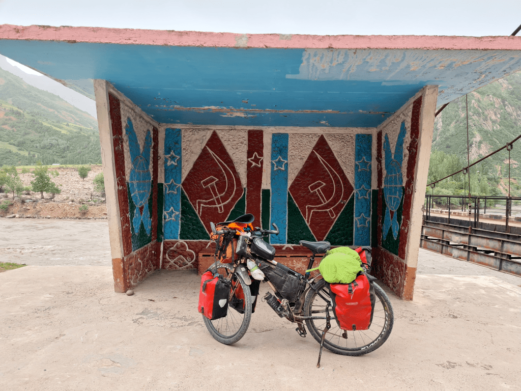
That afternoon we started climbing the pass of Khoburabot, right after Tavildara, the main town of the area. At 3252 meters, it was going to be the highest pass I'd ever cycled (a title held for five years by a pass in the Sierra Nevada at about 2900m, and wouldn't stay with Hurborabout pass for long). We rode for three hard hours and got to about half way up, where we found a flat spot near an abandoned police station and an available stream, so we set up tents.
Then the rain started. I first discovered that my tent was no longer as waterproof as it used to be, and drops of water dripped on my face until I was able to tuck my raincoat between the rain cover and the inner tent.
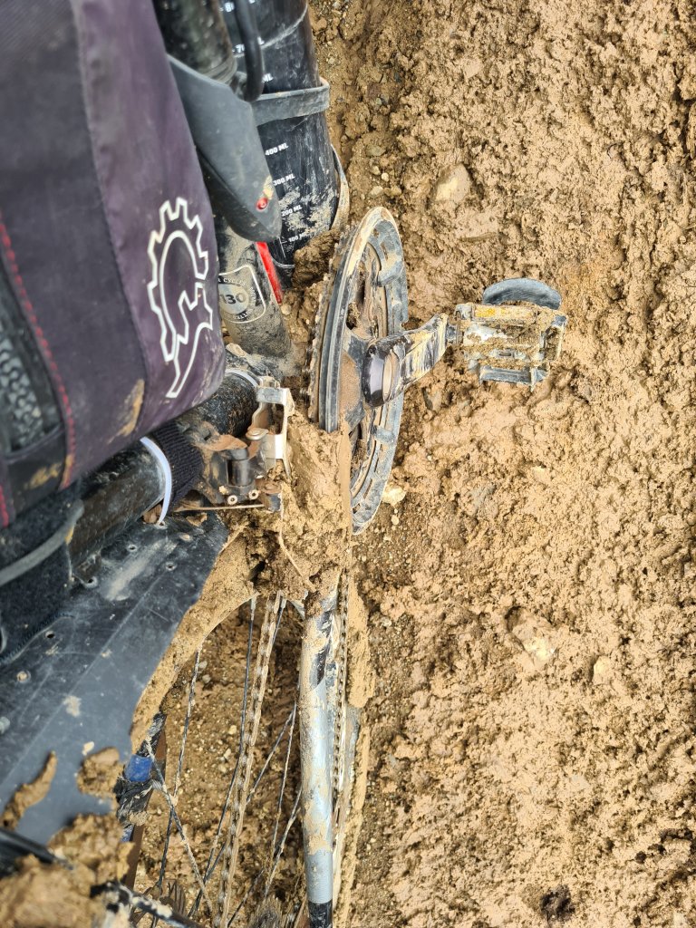
But what we mostly discovered the next morning was that our path had turned into mud. After a few hundred meters of riding, the rear wheel fed the chain with all that goodness, and we had to get off and push. and push and push. For four kilometers of a muddy uphill I pushed the bike. I hate – really hate – pushing the bike- your feet bump into the pedals or bags, you slip and lose grip every now and then, and most of all, it's hard and feels so inefficient. They are supposed to carry me, not the other way around!
After two or three hours that felt like an eternity, the sun came out, the road dried out a bit, and I could clean the chain from all the mud and continue riding carefully (and avoid suspicious muddy areas in the mud like the plague). I stopped for lunch with a group of local shepherds who treated me to chai, bread and an unidentified dish (I'm sometimes too adventurous when it comes to food here) that I'm sure included some mushrooms. Pia and Baldur, who were uncharacteristically behind me most of the day, joined in, and we rode to the pass. But then the rain hit again, the mud came back again, and we went down to push again, mighty pissed. After another round of cleaning the bikes, we rode to the bus station at the top of the pass (yes, there is a bus station there, remnants from the Soviet era, apparently) and hid there just as a barrage of a very angry hailstorm hit the ground.
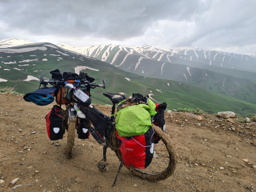
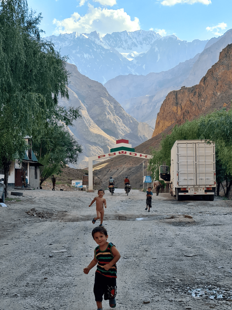
We were debating whether to stay there for the night, as going down this muddy road looked to me somewhat perilous, but all the camping options there were uninviting, to say the least (abandoned buildings full of sheep poop), so we started going down, slowly. The rain stopped, and after a few slow and careful miles, the road dried up completely, and even became paved at times. Then, oh then, it became one of the most wonderful and exciting descents I made on this trip. I descended with great euphoria to Kalai Khalomb, the "official" entrance to the Pamirs, when in front of us we could see the mountains of Afghanistan.
Part 2 – Kalai Khalomb to khorug – a back window to Afghanistan
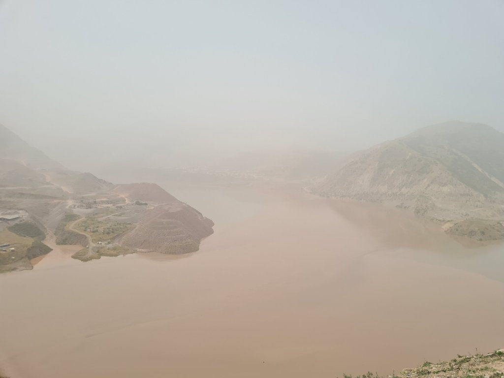
It was interesting to get up in the hostel, look out the window and see Afghanistan across the river, especially as an Israeli passport holder who knows he will never set foot in it. At first I wondered if it was safe to be so close to Afghanistan, but no one else seemed to care, so I shrugged and moved on. In fact, it's not improbable that since the Taliban came to power, they have no interest in doing terrorist acts as much as they used to – they certainly aim to get Recognition as a legitimate government. For Tajikistan on the other hand, the rise of the Taliban was rather bad news, as they suddenly had another hostile country on their border, and more over, a fundamentalist Muslim country.
The attitude of Tajikistan and Uzbekistan to Islam is a rather complex issue. These are countries with a population that is overwhelmingly Muslim, but are defined as secular republics. In the end of the day, when the Soviet Union disintegrated, those who were left to hold the reins of power in Tajikistan, as in the other republics around, were those who were there a moment before – the Communist Party apparatus. Historically, the relationship between communists and religion has never been particularly harmonious, and the Soviets made many efforts, especially in the 1920s, to reduce the influence of the clergy and to secularize the population (There were areas where they were more successful, but the campaign that received the most backlash from Muslims was, and try not to look too surprised, the attempt by the communists to encourage women not to wear hijab or niqab. it didn't end well for some women, to say the least, and i rather not go into details)
On the other hand, the Soviet republics of Central Asia did go through long processes of building a national identity under Soviet rule, and especially after gaining independence. And there is no way to define a national identity in the countries of Central Asia without going through the Muslim heritage. Timur Lang, who became the symbol of the Uzbek nation, was a devout Muslim ruler, for one. And of course, almost the entire population in these countries defines itself as Muslim, and it was clear to the new governments that the "full-on secularization" approach would not work. So today there is a strange situation where the state encourages "traditional" Islamic behavior (the way Central Asians greet each other after a meal is charming to me), and some of the dictators themselves have made a pilgrimage to Mecca, but is very suspicious of people who are "too much" Islamic – too long beards, too many visits to the mosque and so on. For example, there is a ban on minors entering a mosque in Tajikistan, and this is far from being the only restriction on islamic behaviour.
So yes, the rise of fundamentalist Muslim rule across the Panj, the river that runs between Tajikistan and Afghanistan (and I was about to ride along it), did not raise much excitement the government in Dushanbe. I don't know if it changed much in terms of the deployment of the forces there, because there were already many military forces there in the first place to prevent the smuggling of opium and heroin across the border. The Pamir Highway is also known as the heroin highway, since it is one of the main routes through which the Afghan drug dealers export their product to the rest of the world.
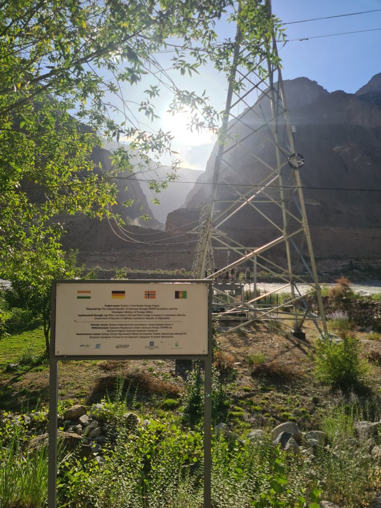
By the way, even if I could enter Afghanistan, I would probably choose to ride on the Tajik side, where I could find small shops every few dozen of kilometers, and look across the Panj to the Afghan side, which was undoubtedly the more picturesque and beautiful of the two. If I thought the Tajik Pamirs were remote and desolate, when I looked at the map to figure out what someone in an Afghan village across the river would have to do to get to anything resembling a normal town with, say, a grocery store, it pretty much stunned me. Yes, the road on the Tajik side is not ideal, as I will soon describe, but you can reach the outside world in a minimum of 10 hours' drive (depending on the definition of "outside world"), and Dushanbe to Khorug is about 20 hours' drive in a normal car ( Less than that in a Jeep). However, the villages on the Afghan side, are *really* cut off, in terms of transportation. I mean, there is a small dirt road between them, but I estimate a drive to the nearest big city in days. And therefore, when it comes to food, they must grow everything themselves, Which means the entire Afghan side is full of beautiful green terraces and plots, while the Tajik side is, well, a little less impressive. It should also be noted that some of the Afghan villages do receive electricity from the Tajik side, a joint project of several European parties and the Aga Khan Foundation (an organization i'll have much to say about later). These projects are from before the rise of the Taliban, but it seems that the Taliban had no interest in not receiving free electricity, so it still happens. Also, I'm pretty sure everyone on the Afghan side has solar panels and batteries, because on the way back from the Pamirs, at night, all the villages on the Afghan side were dotted with little lights, like dozens of fireflies.
On the Tajik side, on the other hand, things are going to change dramatically in the coming years, and we experienced it firsthand right after Qalai Khlumb.
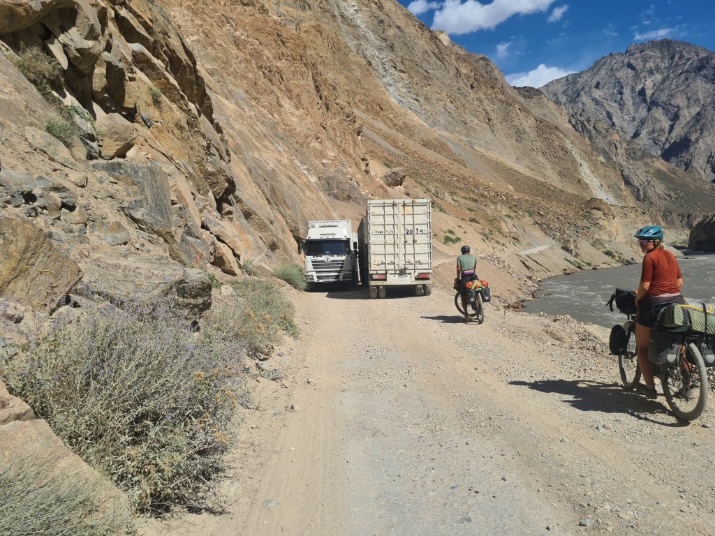
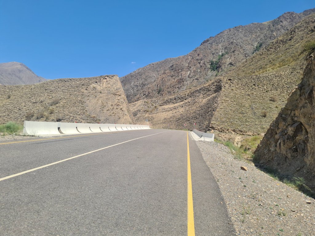
The road from the beginning of the Pamirs (where the checkpoint was) to Qalai Khlumb was a rough dirt road as mentioned, but it did not surprise me, because apart from Tavildara and a few small villages, this road hardly serves anyone (we did the northern route to the Pamir, but there is a paved and boring road to the south) . The road to Khorogh, on the other hand, serves tens to hundreds of thousands of people, and is even more terrible. Seeing two huge trucks doing a careful dance around each other to get between the wall and the abyss was quite nerve wracking. But the days of this road as it is are numbered. Because in 2022, China decided to put 200 million dollars out of its pocket to pave the Pamir Highway. This is of course not due to some special philanthropic impulse. I don't know if this project is an official part of their belt and road initiative, but this road will directly connect Dushanbe to China, and will allow China to export goods to Tajikistan more easily. Of course, this is also a good way to project soft power in the area, and oh, did I mention that the companies that will build the road must be Chinese? A bit reminiscent of American aid to israel.
I'm not exactly sure about the timetables and full plan, but judging by another Chinese road I rode in Kyrgyzstan, there's going to be a real silk road there (it was the smoothest asphalt I've ever seen, that road in Kyrgyzstan). I have no doubt that this road will significantly affect the Pamirs, in a variety of ways, and not all of them are good. It will bring Dushanbe much closer to the Pamir, and while there sure to be benefits from it, i'm not sure most of the Pamiri people will be happy from this sudden proximity. But, and I know I say this a lot in this post, we'll get to that later. For the cycling tourers, no doubt that it will be a pleasure to ride on a less bumpy road, but on the other hand, cars will also travel faster, and there will be many more of them. I suspect that riding there in a few years will feel a little less of an adventure, but I guess that riding there right now feels much less of an adventure than it did ten years ago, among other things because the place is more tourist-oriented than it used to be (although much less than Kyrgyzstan, for example) . This is the constant truth of backpacking and cycling all over the world, by coming to see some remote place, you take a part in the process of changing it.
They didn't come to play around, or to consider the topography
In any case, at the moment it is still a beautiful but very challenging path. One of the most challenging parts of it is to cross the "works" themselves, a part that is notorious among cyclists – it is about several dozen of kilometers that are closed between seven in the morning and 12 in the afternoon, and then again between 13 and 18, which means that you have to cross it as quickly as possible. On top of that, it is an area full of sand and fine powder, and when the roads open, you ride through the dust of of all the cars that travel through . I know of several cyclists who decided to avoid it altogether and hitchhike this section.
But after the ordeal at the pass, this section actually passed quite pleasantly. Except for the two-hour delay in the morning of the second day from Kalai Khomb (which was used to write my journal. I always build up a gap when I'm travelling with people), we didn't encounter any significant obstacles, and the rain that caught us on the pass, and also fell the two nights that followed, greatly reduced the dust. Beyond that , once we were inside the work area, we hardly saw any vehicles.
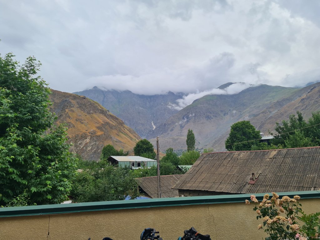
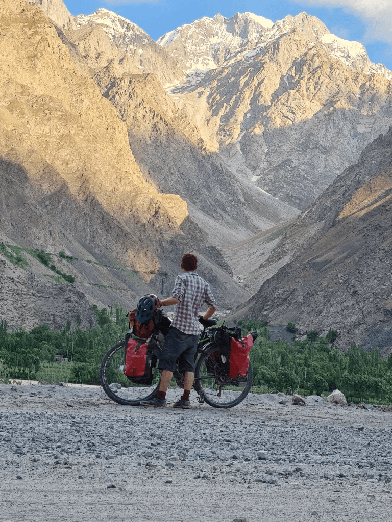
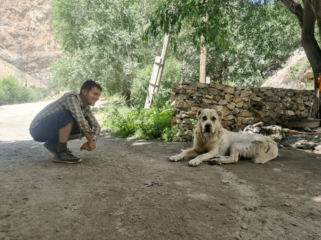
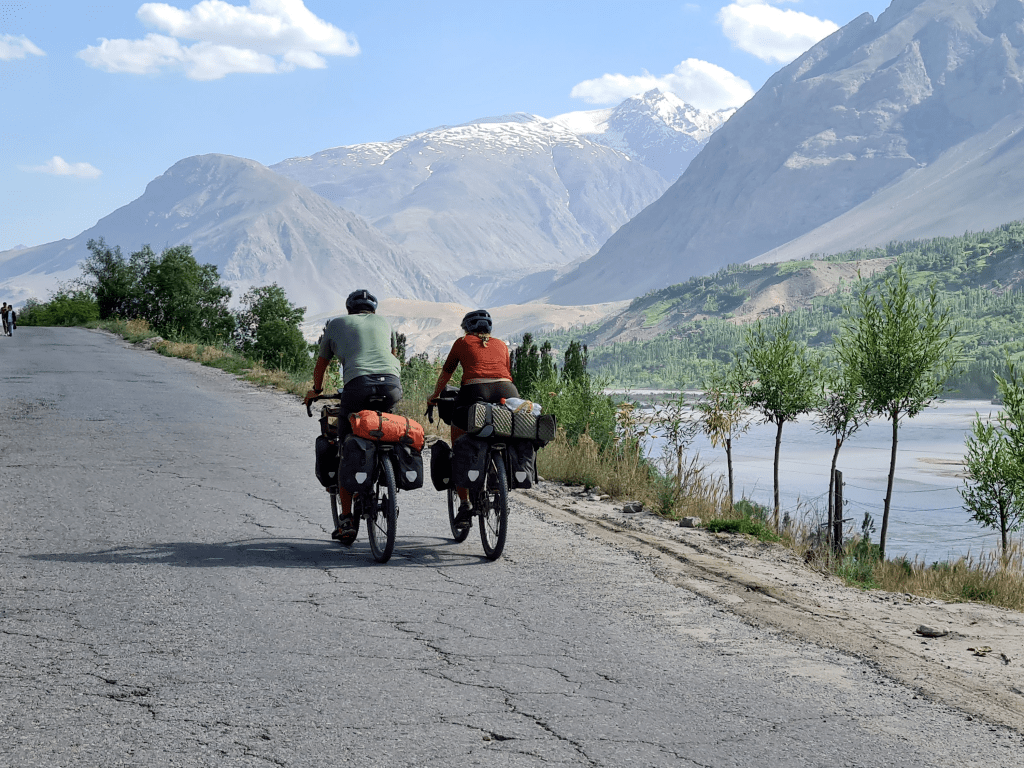
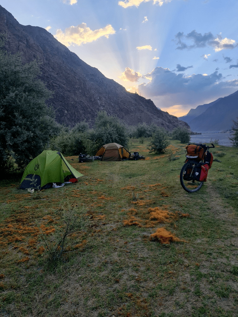
Those days from Kalai Khomb to Khorug, along the Panj River, with Afghanistan on the opposite bank, are, in my memory, one of the best parts of Central Asia. Every so often you go through a turn, and suddenly you see beautiful snow-capped mountains above a majestic desert landscape. From time to time you pass streams or springs (or just a village fountains-taps) and you can wet the shirt or at least the safety vest (it's much easier to take it off the shirt) and cool down a bit, because it's still quite hot (although not crazy hot, we were at an altitude of 2000- 2500 meters). The first evening we stayed at a guest house in a small village, but the next two nights we found beautiful campsites between the road and the river (beautiful and hidden, because the Tajik army doesn't really like people camping in a border area, and there were already stories about riders being moved in the middle of the night). On the fourth day we started to see bits of asphalt again, and in the evening we rolled into Khorug, the capital of Gorno-Badakhshan district, and while it's not exactly a bustling metropolis, it's still a wonder city to me.
In the next part!
Wasting time in Khorog, the atomic imam of one of the most interesting factions in Islam, undulating roads and thought loops in Wakan, a final adventure in the Bartang Valley and what is the very big thing that I completely missed when I was in the Pamirs
